|
|
|
|
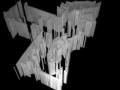
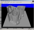
| Laser map of the Innovations gallery from 1999 scan. |
Crude 2D->3D map conversion using an image negative and heightfield in Moray/Povray. |
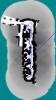
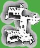
6/14/2001 LOCALIZE testing, map with path. |
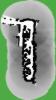
6/14/2001 LOCALIZE testing |
|
|
|
|
|
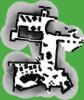
| 6/14/2001 LOCALIZE testing, laserint failure. |
VRML heightfield described by a 600x600 ElevationGrid node (does not conform to VRML97). |
Explorations map from 6/20/2001 scan. |
Path taken during mapping. |
|
|
|
|
|
| Uncorrected planner map. |
Another simple 3D rendering. |
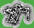
Innovations and Cyberplace map from 6/25/2001 scan. |
Uncorrected planner map. |
|